It looks to have been sited just West of the gap in the South-side terrace.
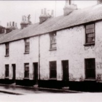
I just noticed that the small 'front gardens' (enclosed by a low wall) of Coastguard's Row seem to disappear at some point - they're there on the 1878 map and 1884 photo, but vanish when Caldwell's baths appear, while those to the West of the gap remain.
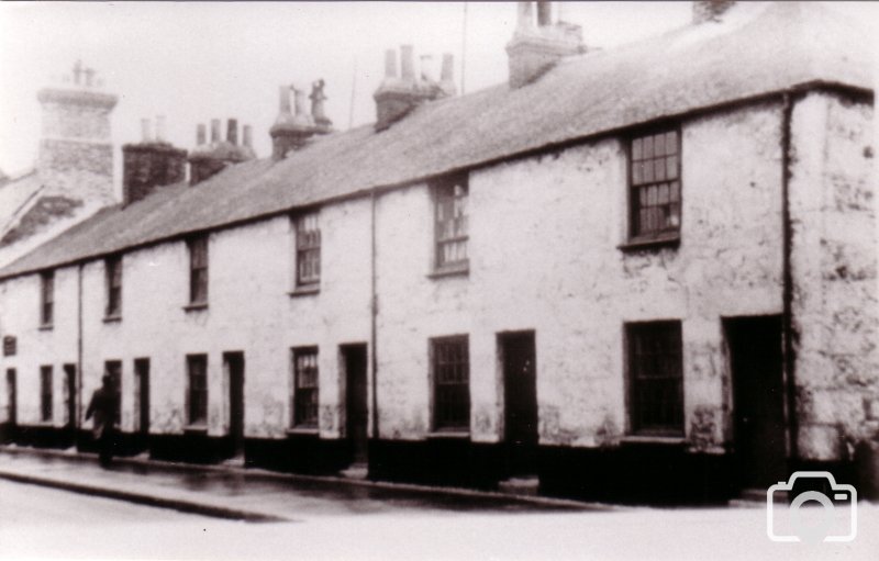
I was looking at the 1871 Census records for the area, it appears that 1 & 2 Gryll's Row (the two that still stand today) were 'Lodging houses', with an 'Enumerator's note' that 'There is no No 1 & 2 Grylls Row'.
Plenty of 'Serpentine workers' thereabouts, though.
A couple of things that puzzling me... I find reference to 'Alexandra Row' immediately preceding the Gryll's Row and Coast Guard Row entries. Where was 'Alexandra Row'? It seems likely that these were not particularly 'high status' houses, as the occupants appear to be mainly 'servants' etc.
The enumerator also counts 11 houses in Gwyll's Row (the map shows only 9, with 7 in Coast Guard as expected), then 2 as 'Wherry', before heading off to Rosevale (up Alexandra Road). I guess he just went up to the Municipal Boundary and turned round.
Moving forward to the 1881 Census Record, we see Nos. 1 & 2 'Beachfield Row' (probably still 'Lodging Houses'), then an enumerator's note: 'Beachfield School,u,,,,,,, ,,Nos 1-5 removed to build school', before picking up again with No.6 through to No. 11 'Grylls's Row', and then on to Coast Guard.
I can find no indication of a school on any map I've seen. Curious.
As if that wasn't confusing enough... 1891 Census Records suggest a Beachfield House, then Nos. 1 & 2 Beachfield Terrace, then Nos. 1 through 6 Gwylls Row (no 'school'), the new Bath House (Caldwell's), then 1 through 7 Coastguard Row, then 1 through 15 Boases Row - presumably the Newlyn-end terrace on the South side (where I count only 11 houses).
Then it's 1 through 12 'West Terrace', with 11 & 12 being 'Mounts Bay Inn' (still standing - for now).
Re: The removal of the front gardens on Coastguard Row:
Cornishman Cornwall, England
6 Jan 1887
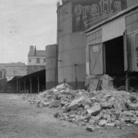
PENZANCE IN 1886
..the Morrab-road. the commencement of the public- baths the site of the old coastguard-station (and the widening of the Wherry-town road adjoiuing, by taking away the gardens, as far as the boundary, formerly belonging to the coastguards' houses) the extension...
Type: Article
I think Wherrytown deserves some investigation so perhaps I'll put a special forum up for collective information and we can post findings there if you are up for it?
I was interested in wherry town as my mum said there was houses down there but I've been doing some looking around and found some photo's of balitho gardens which look really good and I guess these would of been were the skate park is now sort of 1920's, a Mill but got no decent photo's of that yet, but I didn't know there were public baths down there, seems to have been a really interesting area of Penzance over the years.
This site uses cookies to help personalise content, tailor your experience and to keep you logged in if you register.
By continuing to use this site, you are consenting to our use of cookies.