Dry Dock area 1875
treeve

Dry Dock area 1875

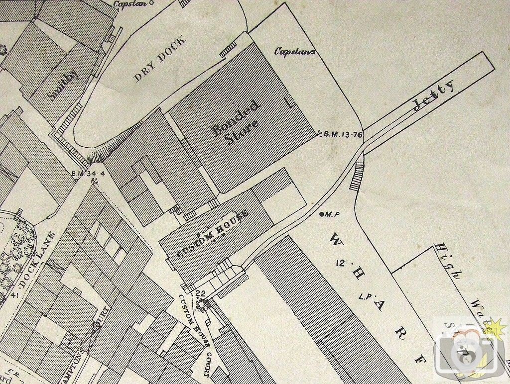
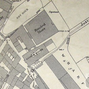
Note the large Dry Dock (of Mathews, built 1814); there was a smaller one at right angles (above the edge of this map); the present Dry Dock was built 1882-1884, and uses the original gates of 1814. This is an extract from Ordnance Survey of 1875. I will be adding details of this area later; but the 1812 Custom House can be seen, as well as the second Bonded Store (now Bosun's Locker and Dry Dock offices).
The Jetty was built in 1861 for the use of the company building the Wolf Rock Lighthouse (more on that later), and was used by Trinity House. When the Wet Dock (or as it was built, Floating Dock ) was commenced and completed in 1884, the Jetty was removed, and the Slip disappeared.
 
I agree, it is totally possible to visualise where it was, the Bonded Store is still extant, as is the Custom House, and the garden of Chapel House and Dock Lane
 
It would indeed, however Ordnance Survey still retain copyright on their maps printed from 1962 onwards; I have all OS for Penzance 1875, 1879, 1908 and 1936, as well as 1962. I am quite happy to place online any portion of any map, except 1962 onwards. Bear in mind that I have not yet finished placing online here more information, maps and pictures. If there is anything at all you particularly want, let me know.
 

Media information

Album
Time past
Added by
treeve
Date added
View count
1,942
Comment count
5
Rating
0.00 star(s) 0 ratings

Share this media

Top Bottom