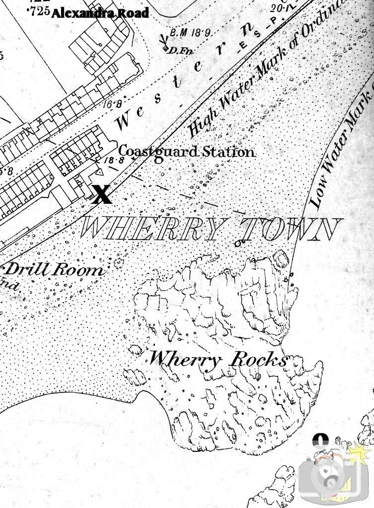
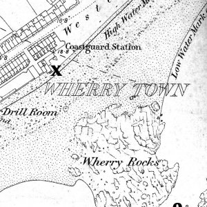
1875 OS map; where
o marks the position of the shaft and
x marks the position of the engine.
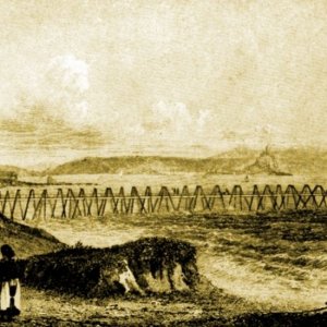
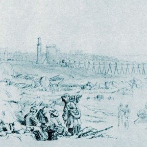
The trestle which ran between them carried the pump pipework and served as access for the men that worked the mine.
The mine was sunk by a wayward American ship that lost anchorage in a storm; I have some details on my webpage on Visitors to the Bay, but I will write up a story for these pictures, including engines etc ....
Fascinating, I didn t know there was a mine there, and only last night I was wondering where Wherrytown got it s name. It must have been very dangerous working there. Just shows how the sea is taking over the land, or does the tide still go out that far. Must say I sound ignorant, but it s something I know little about.
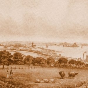
The bay is volatile, in any case, bed is changing place with sand, the whole area is on the move, from side to side, as it always has been; especially since the inundations when the Bay was increased in size. Since the changes in the sea front (Esplanade and later walls and construction, as well as the Jubilee Pool and profile changes after The Ash Wednesday Storm, and now with the Larrigan brook outfall - which has already made changes to sea flow) the material changes will be more dramatic; For some reason it was decided that the mine would be opened at sea, rather than cutting below beach to the elvan dyke, resulting in many problems. When I get a chance I will write it all up for you.
This site uses cookies to help personalise content, tailor your experience and to keep you logged in if you register.
By continuing to use this site, you are consenting to our use of cookies.