treeve Jul 18, 2012 http://freepages.family.rootsweb.ancestry.com/~treevecwll/pztithe.html I will eventually deposit the original with the CRO
http://freepages.family.rootsweb.ancestry.com/~treevecwll/pztithe.html I will eventually deposit the original with the CRO
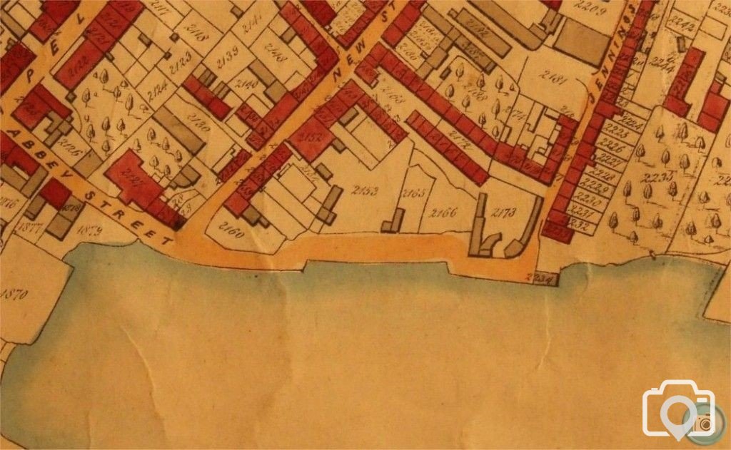
denanmor Jul 19, 2012 Abbey Street was literally a cliff edge then? And are those orchards where the trees are marked?
treeve Jul 19, 2012 As it were, the 'trees' en bloc indicate an orchard, I have a copy of the later tithe property lists.
As it were, the 'trees' en bloc indicate an orchard, I have a copy of the later tithe property lists.