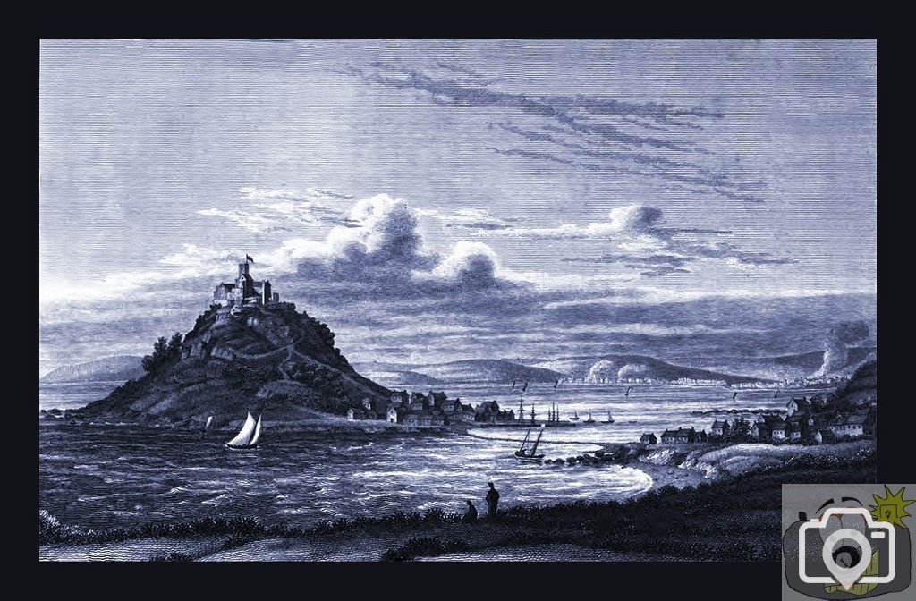
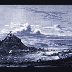
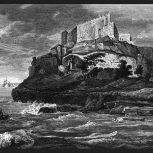
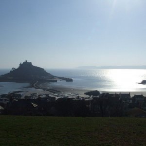
The Causeway (originally simply The Ridge) Polwhele talks about changes to the ridge. The pier was re-built 'about 70 years ago by Sir John St Aubyn, but is remembered to have its mouth to the west, as the new pier has it to the north. It lies at the Mount's end of that ridge of gravel, which in Leland's time was 'the way to the churche entereth at the north syd, from half heb to half fludde'; In 1817 this 'now entereth on the same side for only a few hours of ebb. [Here he draws upon Dr Borlase as to its formation] This ridge, which at the highest spring tides has about thirteen feet of water upon it, but about seven at the top of neap tides, and seven or eight feet at the sides, which is accidentally formed by the two currents of the tide, sweeping around the Mount, meeting in opposite directions beyond it and then depositing at the place of conflict the pebbles, gravel, or sand brought along with them; it had a cross upon it, which about 75 or 80 years ago was broken by the violence of a storm, notwithstanding the protection which the Mount gave it. It being fixed at the lowest part of the ridge, the closing and unclosing (as the first covering and last uncovering of the ridge by the tide are denominated) always happened at this point; but now have changed to a point about 70 or 80 yards nearer Marazion, now made the lowest on the ridge, by carrying oft stone for the erection of some new houses there. The whole ridge is about forty yards wide, no tending directly to the mouth of the pier, but reaching the Mount about eight yards east of it; composed of pebbles, gravel or sand in each of which the predominant quantity is governed by the roughness or stillness of the tides. At neap tides and in bad weather the ridge scarcely uncloses at all, and for only two or three hours in mild weather; but in mild weather and at spring tides, upwards of five hours. Formerly, yet within memory, the ridge was passable half an hour longer than at present; and is now passable only for about 4 hours in the day. So seemingly, so apparent, is the sea encroaching here, within these last few ages.
'The Ridge' is shown also in J Newton's drawing, engraved 1786. In 1515 the chapel is clearly drawn on Chapel Rock, the map also shows the outline of shore and the harbour being open to the north, and the ridgeway there must have been damge to the western pier to have been described in 1817 as being formerly open on the west.
I found a reference somewhere a while back that indicated just when The Causeway was constructed, I know it was altered at each end around 1890, Interestingly the NT do not appear to know, either.
One of the best books of the time, was J Thomas' History of Mount's Bay; when reporting on the great storm of 1817, he states it was such that at the Mount much damage was done: some premises were severely injured ; the road between Marazion and the Mount was torn from the foundations; and stones upwards of a ton weight, though cramped together with massy iron, were severed and removed from their positions.
A direct fact that points to the Causeway having been built very recently, as Polwhele had not made comment. Bearing in mind the scholarly nature of the man, and he did not have a Porsche to make hasty visits, I would estimate it took him two years to write; there is insufficient detail for this 1820 engraving to show, but from Mr Thomas' description, there was a road across, rather than being simply 'The Ridge'. It was therefore built before 1820.
Dr Ayrton Paris writes in 1828 of 1817 ... The towns of Newlyn and Mousehole suffered corresponding damage, and several of their houses were washed away. The road between Marazion and St. Michael's Mount was torn from its lowest foundation, and stones of more than a ton in weight, though clamped together with massy iron, were severed and removed from their situation. The turnpike road between Penzance and Marazion was, in many places, buried with sand; and in others, broken up by the violence of the waves, and covered by the sea to the depth of from three to five feet.
This site uses cookies to help personalise content, tailor your experience and to keep you logged in if you register.
By continuing to use this site, you are consenting to our use of cookies.