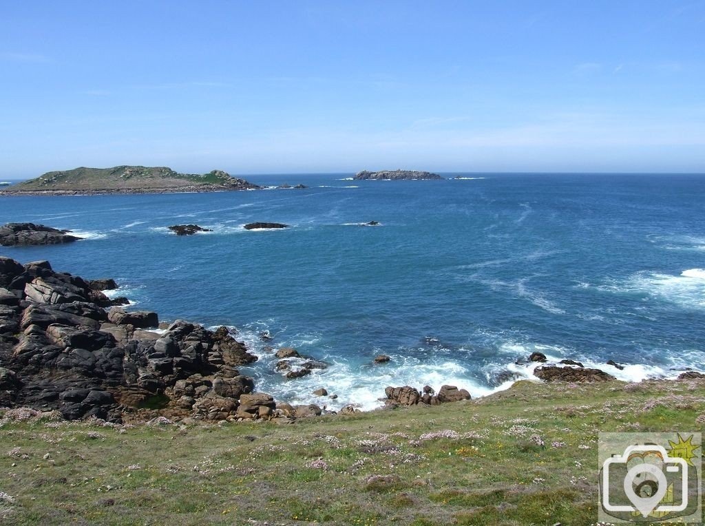
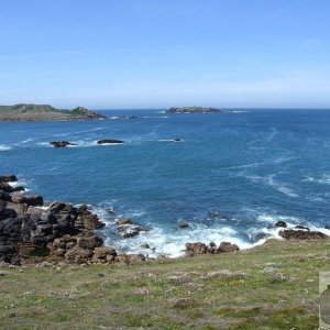
Walking on to Hell Bay, to the right of Gweal, further out, the rock named Scilly comes into view.
Notes added below, on this rock and on the islands.
30th May 2009
Scilly
Rock named Scilly.
The name derives from Sully, pre-English first recorded before 100AD.
The Isles of Scilly have been known for many centuries from the ancient world, by various names.
Known in Scandinavia as Syllingar, the islands have become entwined with the myths of Lyonesse and even Atlantis,
the Celts knew them as The Isles of the Blest (Isles of The Dead),
they have become entwined with Avalon and Glasinnis, Land of Shades.
They were known as The Gardens of the Hespirides, as Fortunate Isles (Fortunatae Insulae).
The islands (island) have been occupied since before 4,000BC.
They were known to the Greeks as Cassiterides (Timaeus says six Islands of the Gods, called The Fortunate Islands).
Strabo states in 18AD The Cassiterides are opposite the west parts of Britain,
and continues to give a full account of the inhabitants and their life.
In that the inhabitants differed strikingly from their neighbours on the mainland in Belerion,
The Damnonii were roughly clad in animal furs, whilst the Cassiterideans were clad in black cloaks and tunics to the ground.
It is in the writing of Diodorus Siculus that we get a closer defined look at the islands.
He writes in the 1st century AD 'a peculiar phenomenon in connection with the neighbouring islands,
at the flood tide the intervening passage is overflowed and they seem like islands,
but a large space is left dry at the ebb and they seem to be like peninsulas.
Following in the path (long held secret by the Phoenicians) to the tin islands,
the Romans under Publius Crassius arrived seeking trade;
besides the fact that the islands were used as a banishment facility -
in 384AD the proclaimed heretic Instantius was banished from Rome to Insula Sylina.
Some say that the Islands took the name of Scilly (Sylla/Sula) from this rock.
The fact is that out beyond this rock 3,000 miles away is Newfoundland.
The sea bed rises evenly from the continental shelf until it reaches the Overfalls.
The ocean swell is magnified at that ridge (near the horizon in this picture),
and can often be seen as an area of white tops, as the ocean swell rises from 50 fathoms of water to 38 and then to 45 again.
It then hits the ledge of which the rock Scilly is a part at 12 fathoms, the majority of the shore water here is at 7 fathoms.
This is in direct contrast to the nearby gentle curves of sandy beaches of the south of Bryher.
Raymond Forward